Mesa Verde National Park
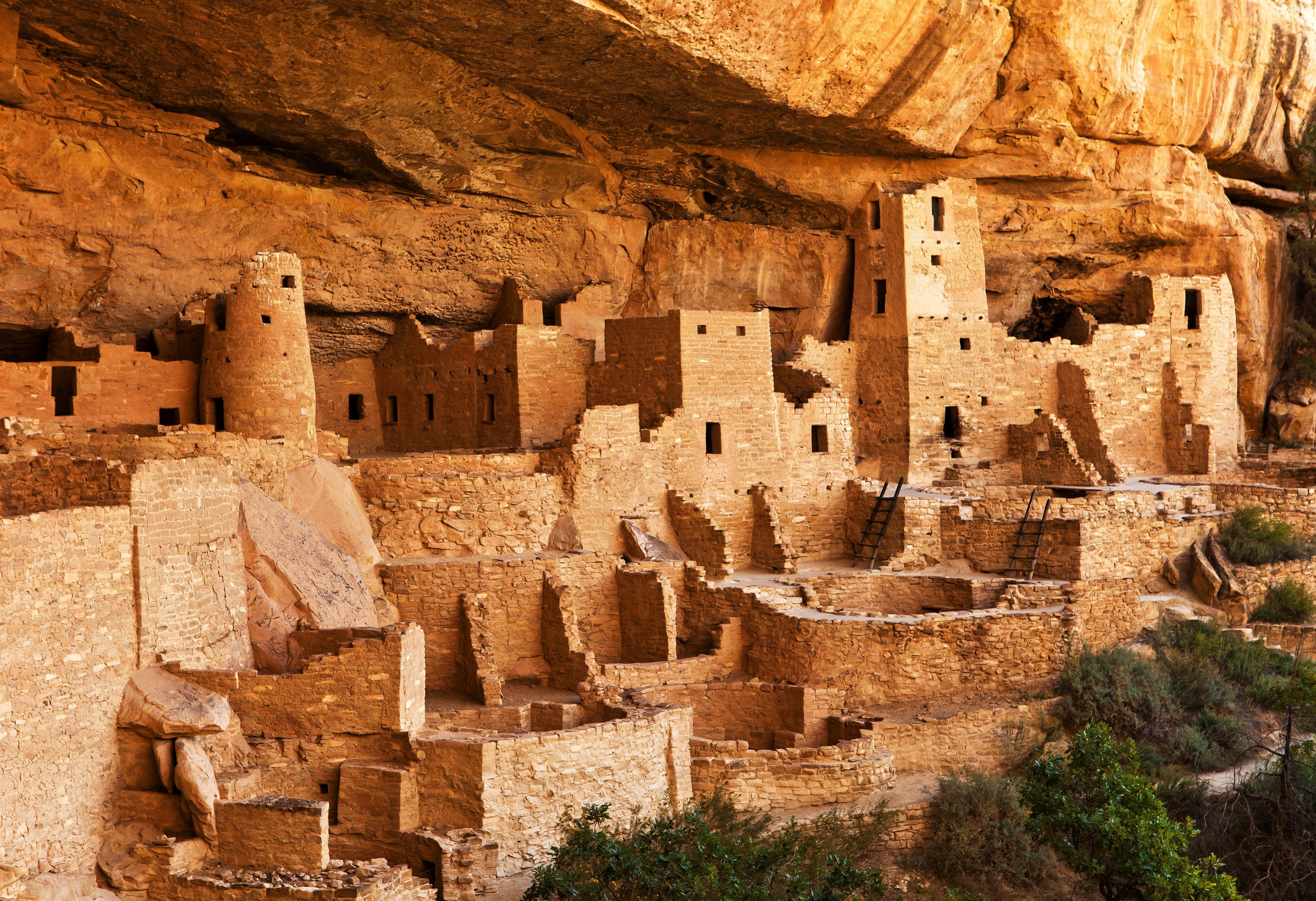
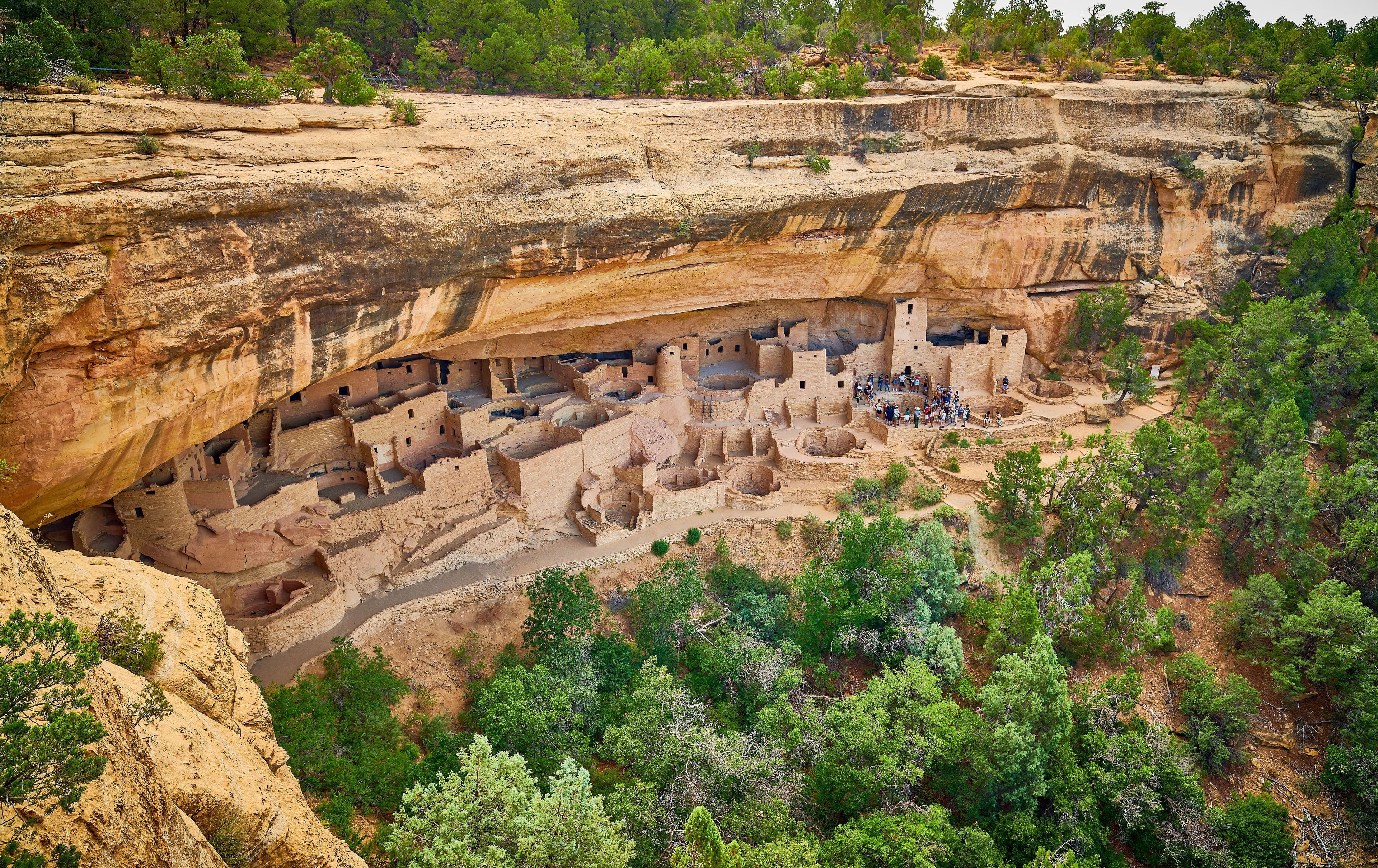
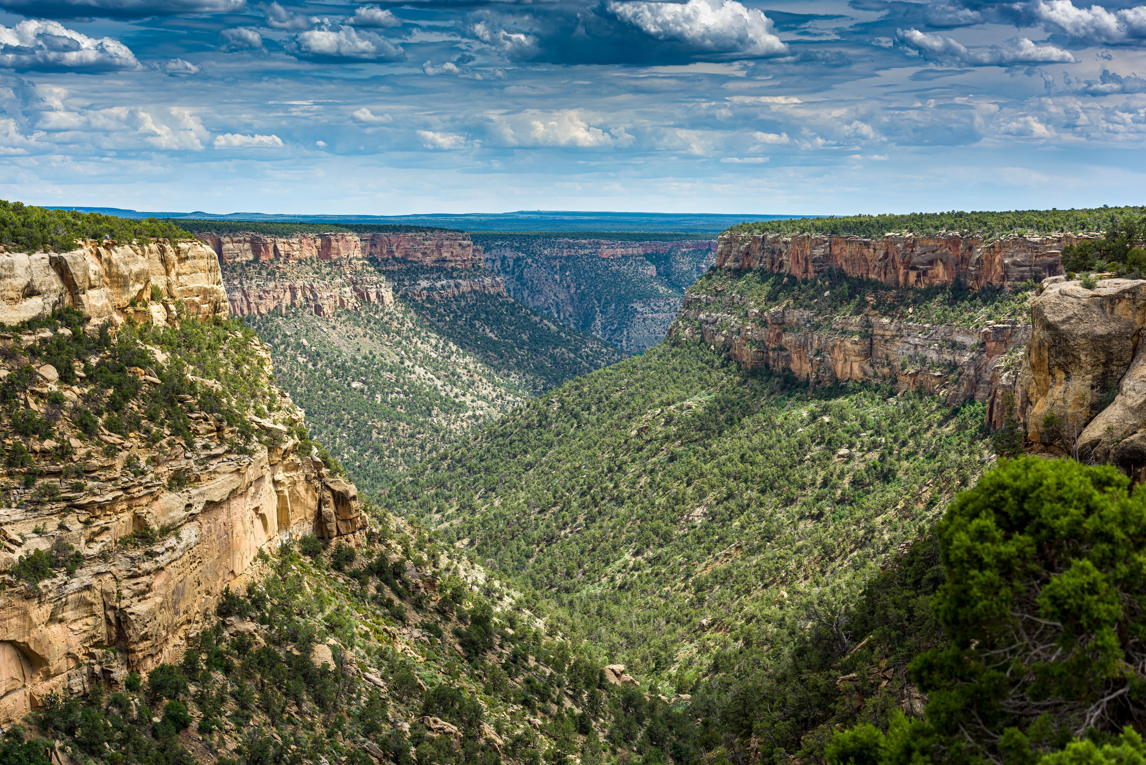
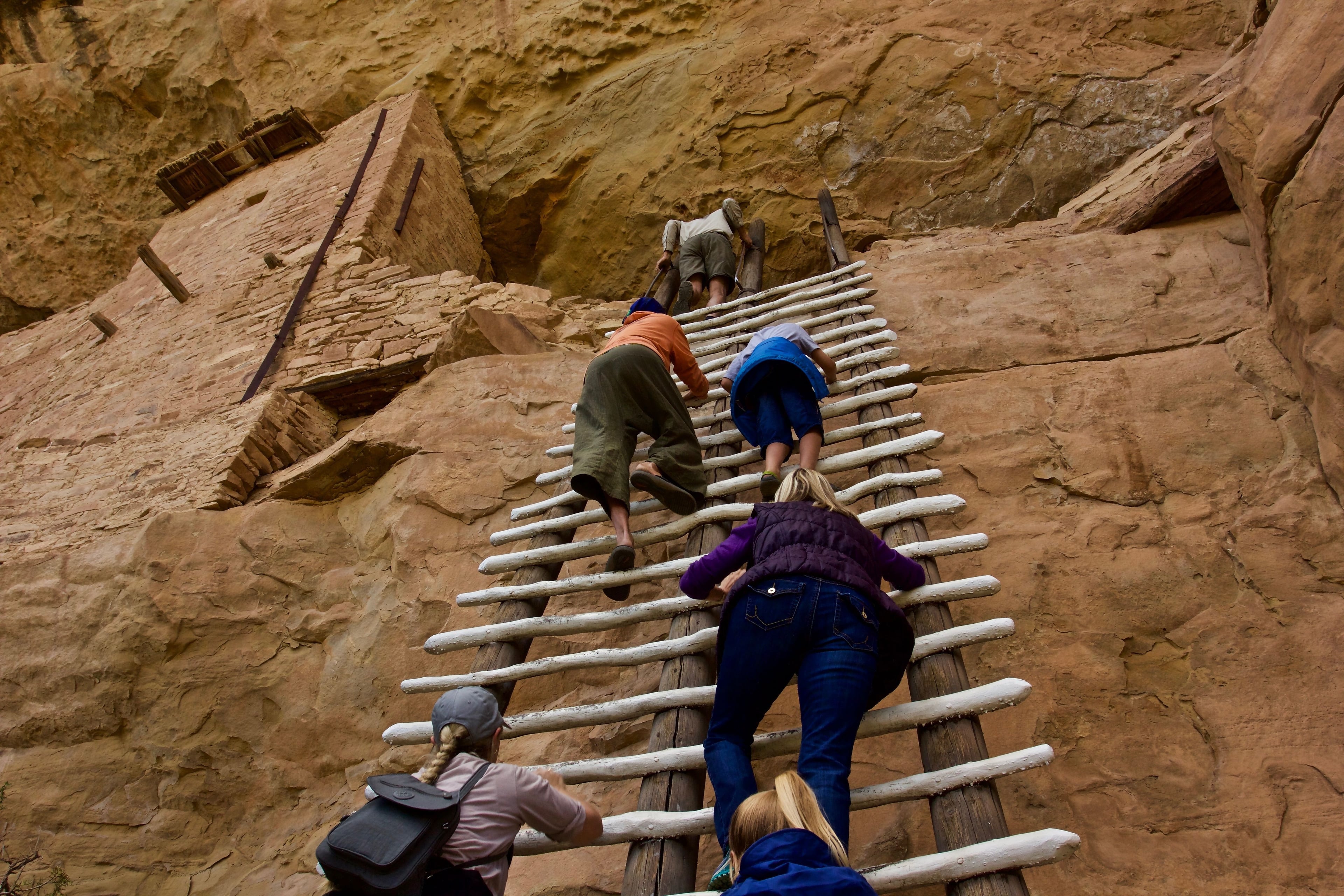
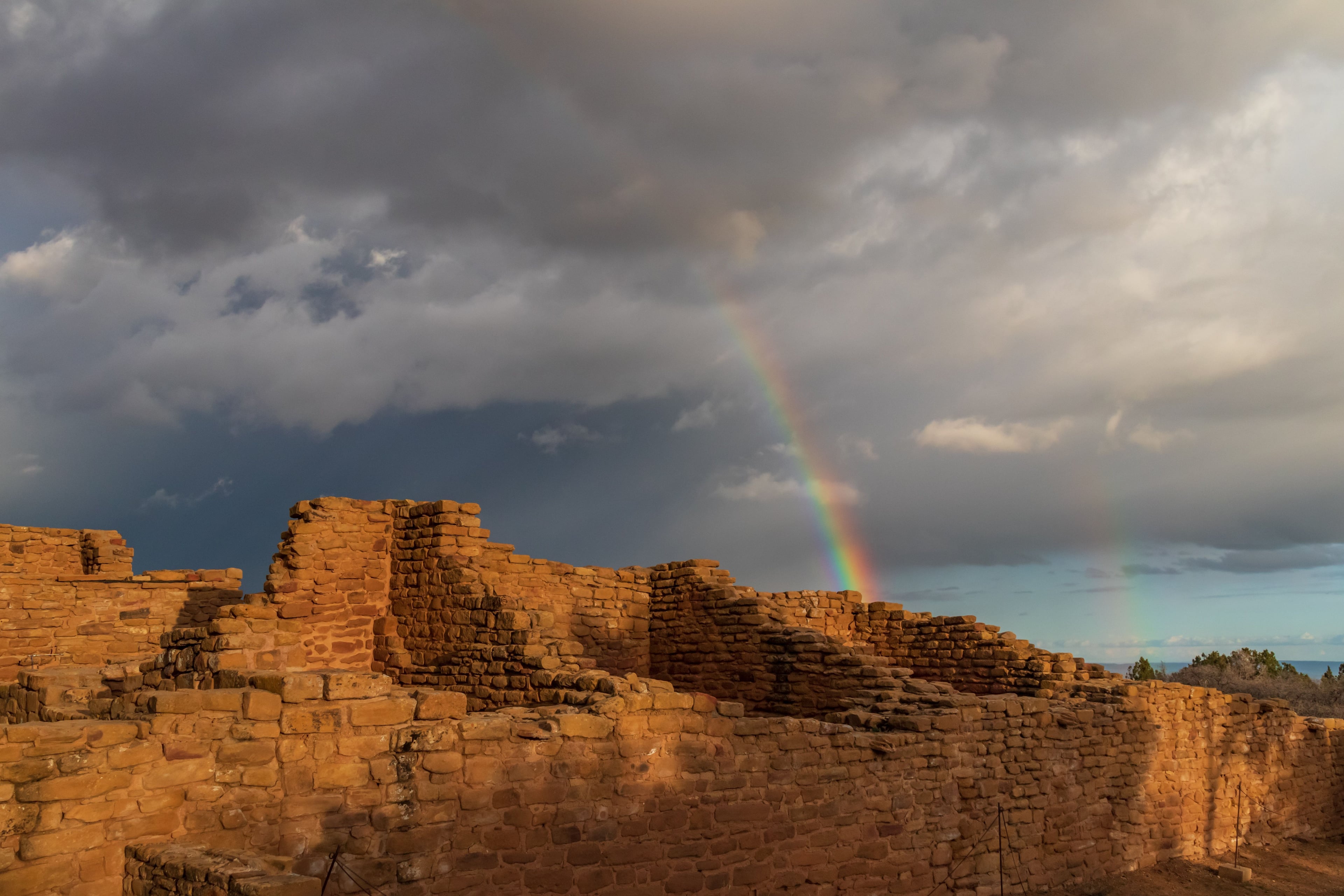
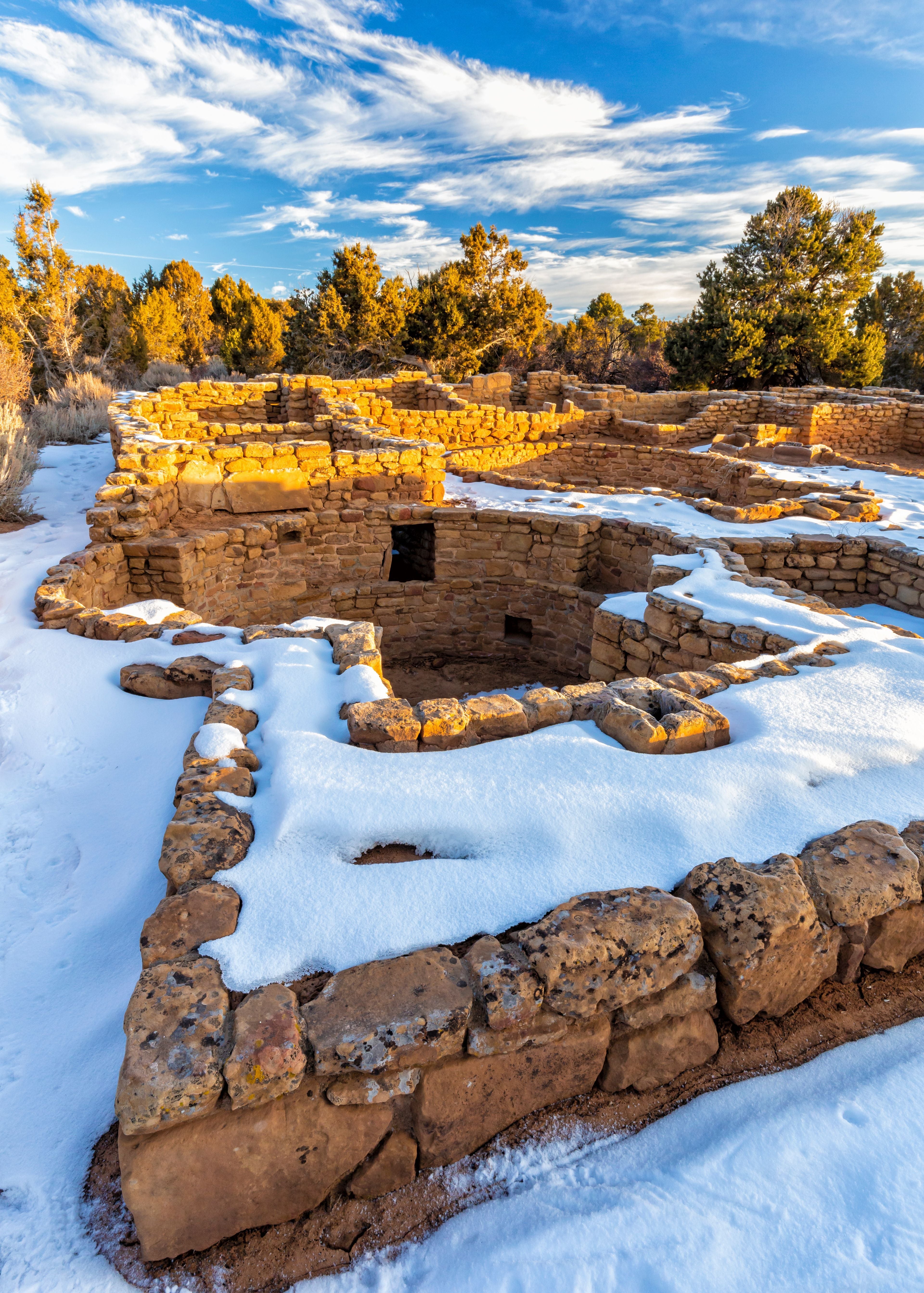
Mesa Verde National Park preserves an extraordinary collection of archaeological sites, including nearly 5,000 locations and over 600 cliff dwellings that showcase the history and culture of the Ancestral Pueblo people. Covering more than 52,000 acres of rugged canyons and mesas, the park offers a unique combination of natural beauty and cultural heritage, with elevations ranging from canyon bottoms to the high mesa top at Park Point. Designated as a UNESCO World Heritage Site and International Dark Sky Park, Mesa Verde highlights both cultural significance and environmental protection. Visitors encounter striking panoramic views, diverse plant and animal life, and opportunities to explore cliff dwellings, mesa-top villages, and interpretive trails that reveal centuries of human and ecological history.
Type of Area
National Park
Address
Nearest Town
Durango
Key Features
Park Size
52,485 acres (82 sq. miles / 212 km²)
Highest Point
Park Point - 8,572 ft (2,613 m)
Major Wildlife
Mule deer, black bears, coyotes, elk, wild turkeys, bobcats
Miles of Trail
30 miles of hiking trails
Popular Activities
Ranger-led cliff dwelling tours, hiking, scenic driving, stargazing, wildlife viewing, cultural history tours
Scenic Views
Cliff Palace, Balcony House, Spruce Tree House, Mesa Top Loop Road overlooks
WiFi Access
Limited - available at the Visitor and Research Center near the park entrance
Best Time to Visit
Late spring through fall (May to October) when most sites and roads are open
Overview
Mesa Verde National Park protects some of the most notable and best-preserved archaeological sites in the United States. With over 700 years of human occupation, the park tells the story of the Ancestral Pueblo people through thousands of archaeological sites, including iconic cliff dwellings built into steep canyon walls. Visitors can explore both mesa-top villages and canyon sites that highlight the architectural and cultural achievements of these ancient communities.
Maps
Maps
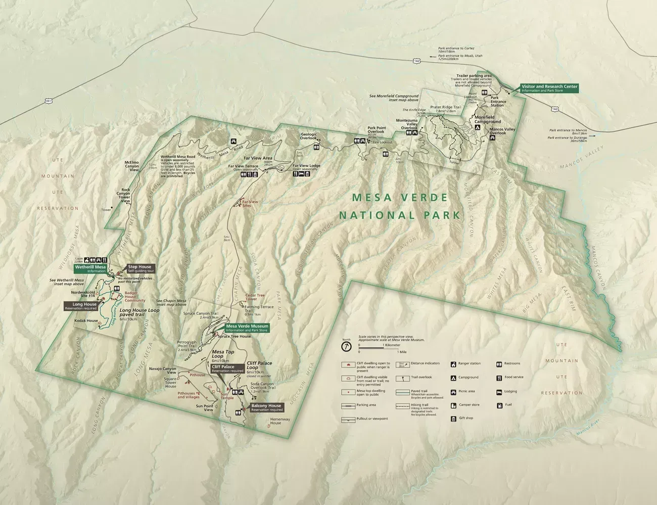
Maps are essential for navigating Mesa Verde’s vast mesas, canyons, and archaeological sites. The park covers more than 52,000 acres with elevations ranging from 6,000 to over 8,500 feet, and its road system includes scenic loops, overlooks, and access points to major cliff dwellings. A detailed official map helps visitors plan routes to the Visitor and Research Center, Chapin Mesa, Wetherill Mesa, and trailheads. In addition to the main park map, specialized hiking and driving maps provide guidance for self-guided exploration. These resources highlight trails, parking areas, restrooms, and significant archaeological sites, ensuring visitors can safely experience both cultural and natural features of the park.
Entrances & Fees
Park Entrances
Mesa Verde National Park has a single main entrance located off U.S. Highway 160, about ten miles east of Cortez, Colorado. Because the entrance is the only access point into the park, all visitors must pass through it, whether they are headed to the Visitor and Research Center, Chapin Mesa, or Wetherill Mesa. Seasonal closures and weather conditions can affect travel, so visitors are advised to check current conditions before arrival.
Fees & Passes
Mesa Verde National Park charges an entrance fee that changes with the season and the type of entry. During the summer (May through October), vehicle fees are higher, while in winter (November through April) they are reduced to encourage visitation during the quieter months. Visitors may enter by private vehicle, motorcycle, bicycle, or on foot, with children under 16 admitted free of charge. Commercial tours are priced separately depending on vehicle size.
Activities
Accessibility & Seasonal Info
Accessibility
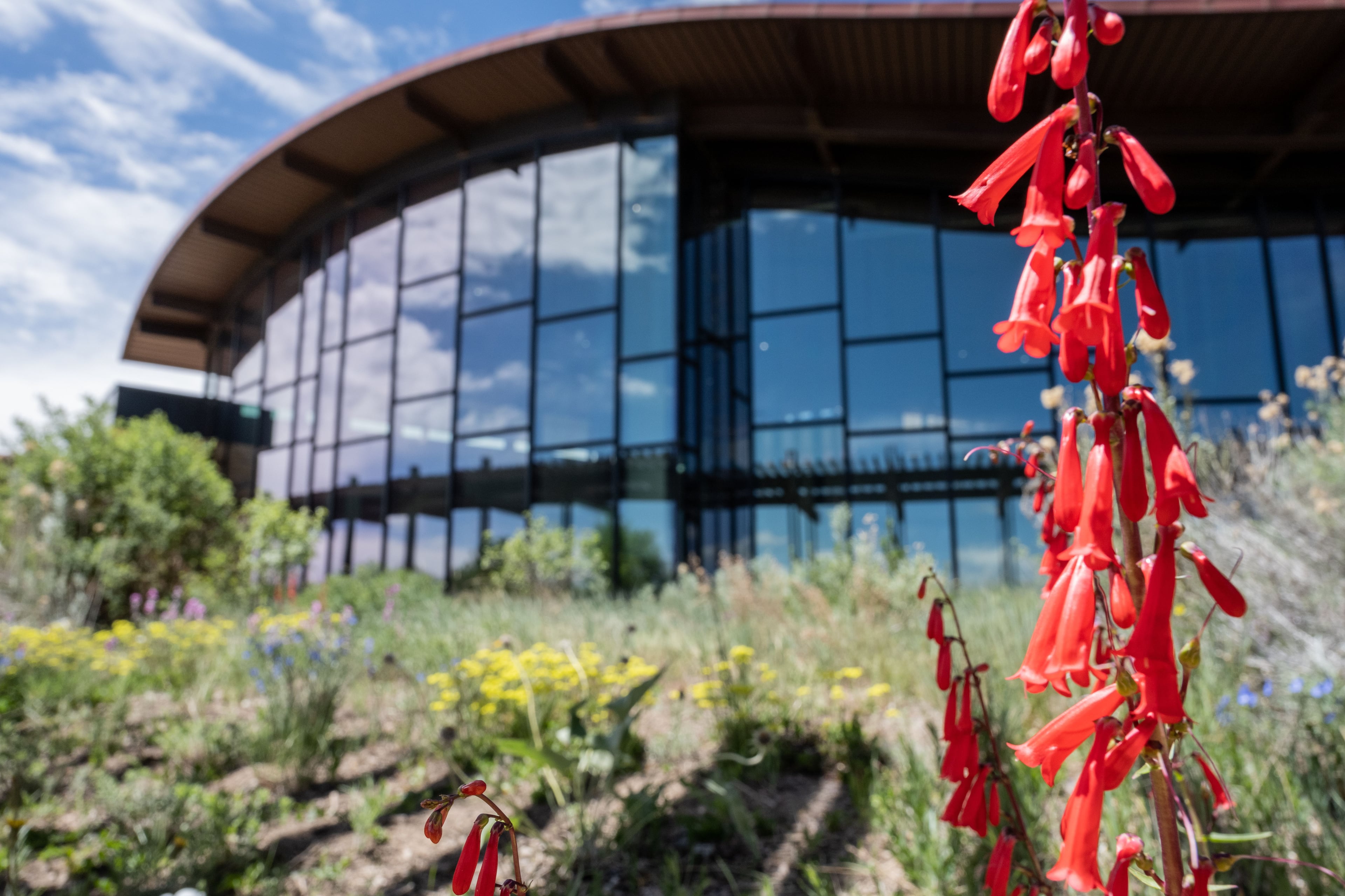
Mesa Verde National Park offers a range of accessible facilities, including wheelchair-friendly overlooks, restrooms, and the Visitor & Research Center.
Seasonal Access & Weather
Mesa Verde is open year-round, but some cliff dwellings and roads are closed in winter due to snow and weather conditions.
Seasonal Closures
Seasonal Closures
Mesa Verde experiences seasonal facility closures and temporary restrictions due to weather, road conditions, and wildlife protection.
History & Culture
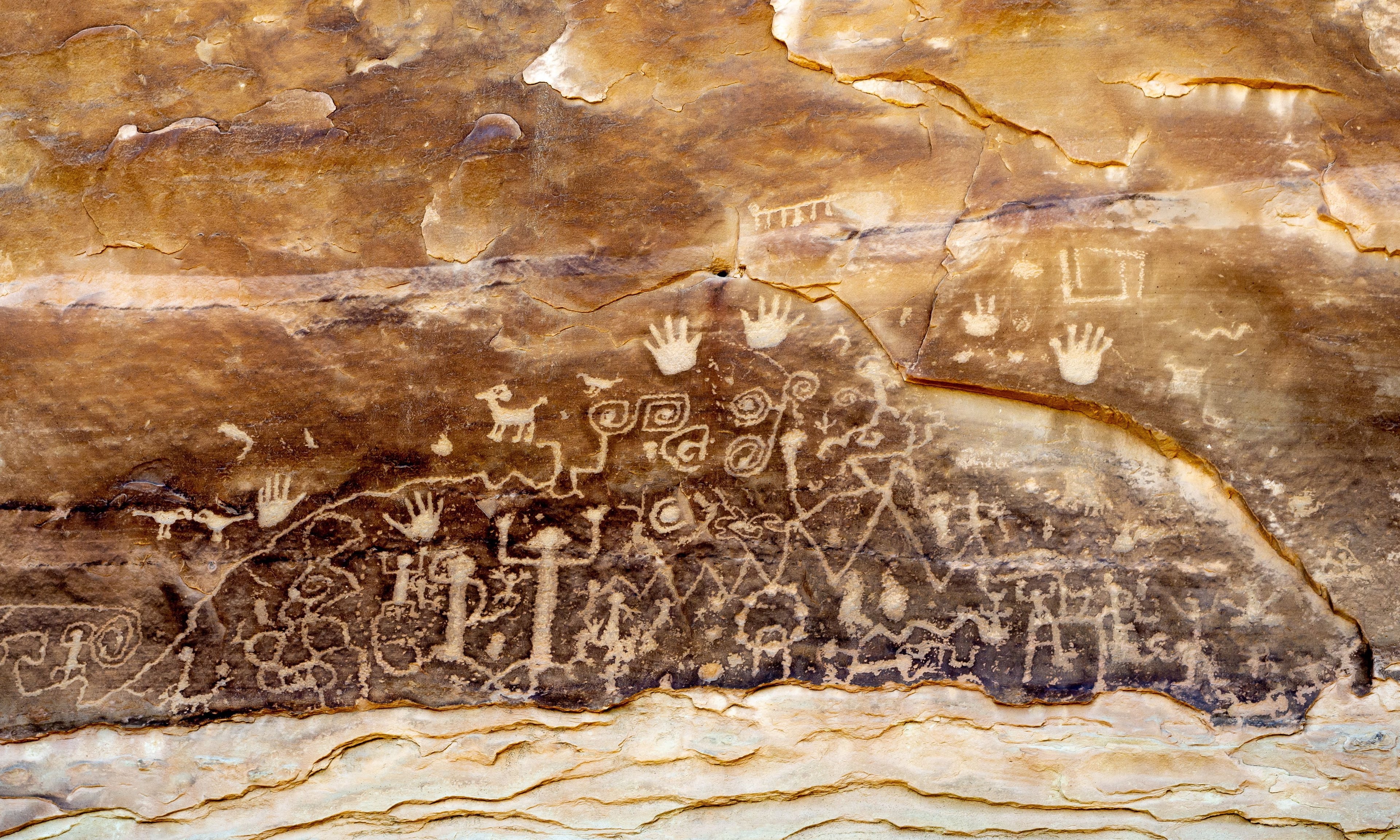
History & Culture
Mesa Verde National Park is a place of profound historical and cultural importance, preserving the heritage of the ancestral Pueblo people. It is a protected cultural landscape where ancestral communities built stone villages on mesa tops and within cliff alcoves, and where living Tribal nations continue to guide stewardship, interpretation, and care.
Geology & Ecology

Geology & Ecology
Mesa Verde's unique geology and diverse ecology are a perfect backdrop for its fascinating history. This gently tilted plateau cut by deep canyons creates alcoves in sandstone cliffs and supports woodlands, shrublands, and riparian pockets that shelter a wide range of plants, birds, and animals.
Regulations & Considerations
Regulations & Considerations
Visitors should review park regulations and safety guidelines before their trip. Rules are in place to protect both the natural environment and visitor safety.